(PhotoCollection T Gault - Canada - 044, via
http://www.noviomagus.nl/Gastredactie/VDHorst/VDHorstE.htm)
(Bruce Frederick)
In August 2011, my wife and I took an 8-day river cruise up the Rhine from Amsterdam to Basel, Switzerland (Amsterdam connects to the Rhine via a canal).
This was primarily a relaxing vacation to celebrate our 25th anniversary, so I tried to keep a lid on my tendency to focus on World War 2 history. However, the opportunity to see Allied crossings of the Rhine was too good to ignore, so for certain stretches of the river, I took a lot of photographs and since our return, have attempted to match them up with photos from 1944-45. I hope you find the results of interest.
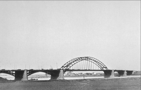
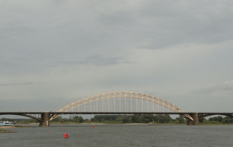
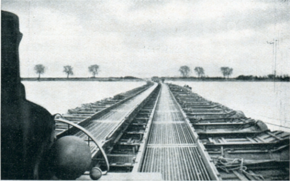
This was the last bridge that the Allies successfully captured and held during Monty's disastrous "Market Garden" operation. The final bridge at Arnhem never fell, and gave rise to the name "A Bridge Too Far".
|
(PhotoCollection T Gault - Canada - 044, via http://www.noviomagus.nl/Gastredactie/VDHorst/VDHorstE.htm) |
(Bruce Frederick) |
Although the bridge site at Remagen is famous, we passed by it at about 4 AM, and after retiring at midnight and setting the alarm for 6AM, I just couldn't get motivated to wake up and go on deck in the dark to pass by a bridge site. Sorry. And I must have blinked and missed the Third Army crossings at Rhens and Boppard. In any case, there's not much in the way of information or photos on-line about these crossings, so these are not included here.
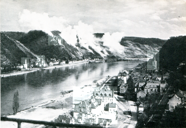
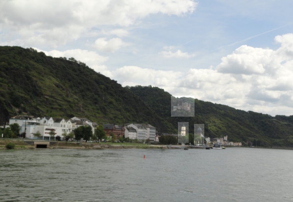
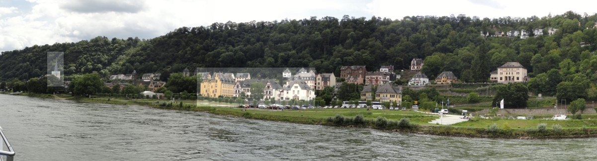
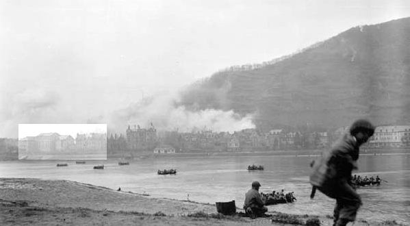
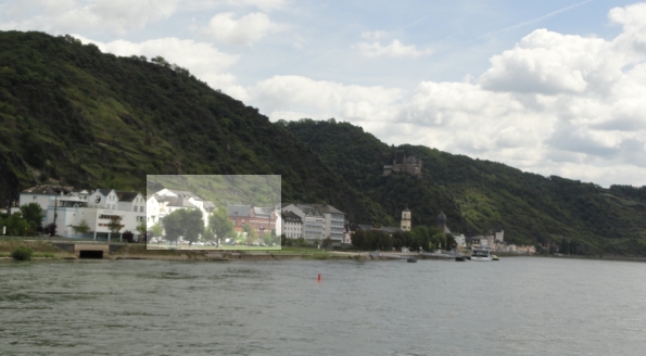
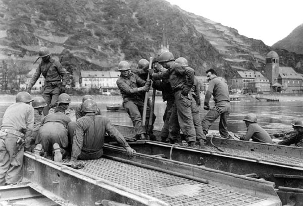
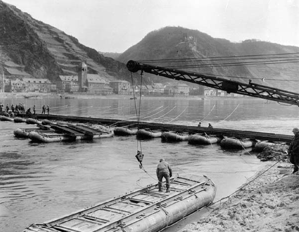
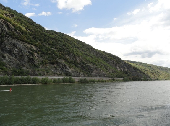
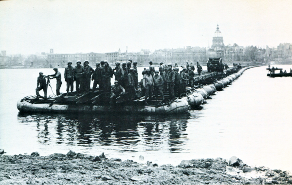
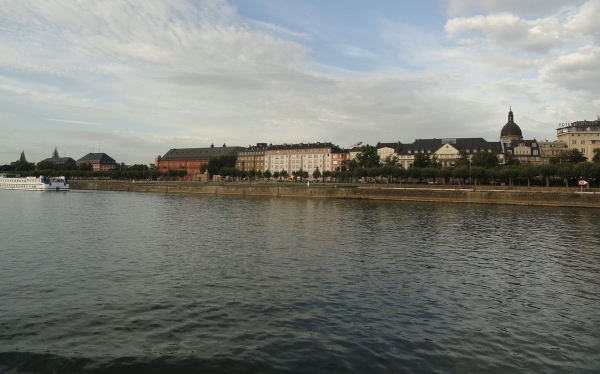
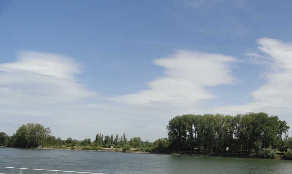
Now we start to get into the good stuff. Heading up-stream (south), St. Goar is on the west (starboard) bank, and St. Goarshausen is on the opposite bank. As the American 89th Division approached the Rhine through St. Goar, they started to take heavy fire from German positions across the river in St. Goarshausen. St. Goar survived relatively unscathed. St. Goarshausen was very heavily damaged. As you may know, Third Army policy was to bypass and leave mostly undisturbed towns that surrendered peacefully, and to absolutely flatten any town that resisted. Drifting past these two idyllic towns on a sunny day in 2011, it's impossible to imagine the fighting and destruction that took place here 66 years ago.
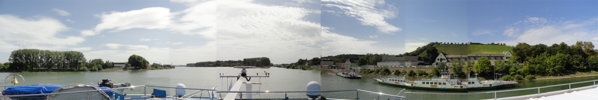
It's a little hard to line up the 1945 overview photo which was taken from the top of the gorge on the St Goar side, with the 2011 photos taken from the middle of the river. But there are two towers and a castle on the eastern bank, and a couple of substantial buildings and a steeple on the western bank, that I have highlighted in the following three photos. (The panorama shot of St. Goar is stitched together from several smaller photos which were taken from a moving boat, so some of the buildings appear to have extra "ghost" wings and additions.)
(Imperial War Museum, via Patton's Third Army at War, George Forty, Charles Scribner's Sons, 1978.) |
(Bruce Frederick) |
(Bruce Frederick) |
When it comes to the water-level photos of the crossings, it's a little more difficult. Unfortunately, I was paying too much attention to St. Goar and not enough attention to St. Goarshausen, so I have only a couple of photos of the latter and the angles are all wrong to compare easily to the WW 2 photos. However, after spending a lot of eye-squinting comparison time, I believe the buildings in the two highlighted areas match up.
 (National Archives, via http://www.gallagher.com) |
 (Bruce Frederick) |
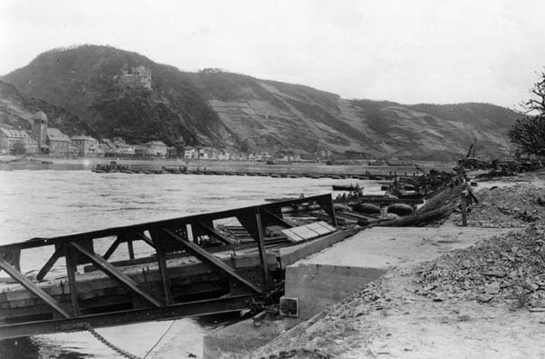
The following three photos can be placed by the tower visible on the St Goarshausen side:
 (National Archives, via http://www.gallagher.com) |
 (National Archives, via http://www.gallagher.com) |
 (National Archives, via http://www.gallagher.com) |
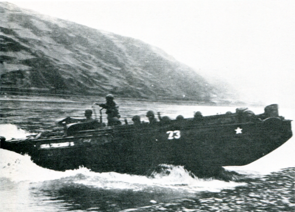
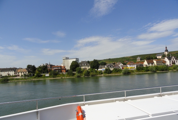
I have only one WW 2 photo of Oberwessel, showing an 89th Division DUKW entering the water from the west bank. The east bank doesn't show any distinguishing landmarks except the general shape of the terrain in the distance. If this 2011 photo isn't at the exact same spot, it's darn close.
(US Army, via Patton's Third Army at War, George Forty, Charles Scribner's Sons, 1978.) |
(Bruce Frederick) |
The Mainz crossing was forced by the 80th Division at 0100 on March 28.
Although I got a decent shot of the Mainz Christuskirche dome at a similar angle to the pontoon bridge crossing, I failed to get good shots of the opposite shore or of the Theodor Heuss Bridge. Unfortunate, as there are several WW 2 photos against which to compare. Maybe next time.
Oh, and one other thing: while working with these photos, the height of the dome has bothered me. It just looks too high in the WW 2 photo. I haven't been able to figure out the discrepancy. I am certain (well, 99% certain) that they are the same dome, and Christuskirche was not destroyed and rebuilt. Although the dome appears to be a skeleton in the WW 2 photo, that is actually sunlight reflection off the bronze finish. If anybody can explain why the 2011 dome looks so much lower, I'm interested in theories.
(US Signal Corps, via Patton's Third Army at War, George Forty, Charles Scribner's Sons, 1978.) |
(Bruce Frederick) |
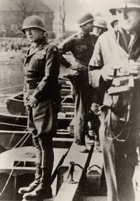
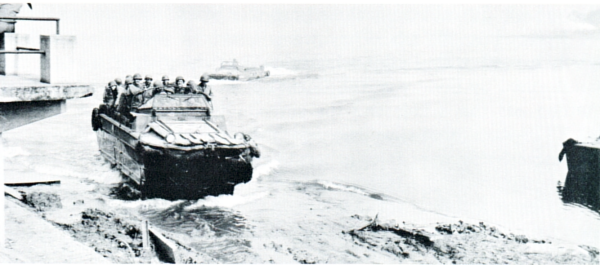
Notable for being one of the first two Third Army crossings (the other being Oppenheim, see below), forced by the 5th Division at 2200 on March 22. Also notable for being the crossing where Patton famously stopped his jeep in the middle of the pontoon bridge, and then urinated into the Rhine. He also feigned a stumble on the east bank and grabbed two fistfuls of German soil, in emulation of William the Conqueror. There is also a photo of a 6th Armored Division DUKW coming ashore.
Unfortunately, none of the WW 2 photos give a clear, wide shot of the Nierstein crossing, with visible landmarks. All we can do is speculate as to where the photos were taken, compared to a wide shot of the Nierstein waterfront. The building behind Patton's head could be the building second from the left in the 2011 shot, but that's pure speculation.
(Unattributed) |
(Bruce Frederick) |
Likewise, it's really impossible to pinpoint the location of the DUKW photo given the lack of detail. I'm not even sure which shore the photo is taken from.
(Super Sixth, George F Hofmann, 1975) |
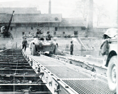
Along with Nierstein which is less than two kilometers downstream, Oppenheim shares the credit for being the first Third Army crossing of the Rhine. (Remagen was taken by First Army.) It's also of the most personal interest to me, since this is where the 6th Armored Division crossed the Rhine.
I suppose we should get the peeing photo out of the way. 6th Armored Division Commanding General Robert Grow repeated his commander's performance:
(Super Sixth, George F Hofmann, 1975)
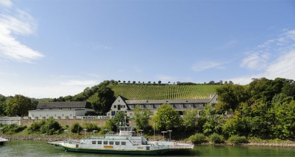
There is a good photo in Hofmann's "Super Sixth" of the west bank at Oppenheim. The buildings have changed, but I *think* this is located at the current ferry crossing.
(Super Sixth, George F Hofmann, 1975) |
(Bruce Frederick) |
There are several WW 2 shots of the east bank at this crossing, but they just show a bleak landscape with a few trees:
(Combat History of the 128th Armored Ordnance Maintenance Battalion, 1945) |
(Bruce Frederick) |
Like the St. Goar panorama photo above, this Oppenheim pan is stitched together from several photos made from the deck of a moving boat, so the seams in many cases are very rough, particularly on the west bank where three instances of the same ferry overlap each other. Still, it gives you a rough idea of what the river is like at this particular crossing site.
(Bruce Frederick)